
Cadastral surveying refers to applying the relevant laws, principles and the physical definition of property boundaries in defining rights and interest in land.
DSQ holds accreditation with the Department of Resources (DoR) in Queensland for the endorsement of survey plans.
DSQ Surveyors are registered to perform surveys in Queensland, New South Wales and the Northern Territory.
At DSQ we have considerable expertise in cadastral surveying and can provide solutions for:
• Land titling
• Land subdivision and development
• Community title schemes & Building Format Subdivision
• Easement surveys
• Resumption surveys
• Volumetric surveys
• Leases of commercial tenancies, buildings & land
• DCDB upgrades
At DSQ we utilise the latest in surveying hardware and software to provide effective solutions to your engineering and construction survey requirements.
Our team has considerable experience in undertaking varied tasks including:
• Project survey control networks
• Detail and level surveys
• Surveys for engineering design
• Building construction set out
• Road set out
• Machine Guidance Control Systems
• As-constructed surveys including ADAC
• Asset documentation
• Deformation / monitoring surveys
• Cultural Heritage surveys
• Environmental mapping
DSQ Pty Ltd has GIS experts that will help you through the entire project cycle. Utilising the latest GIS & Data Management software, we will add value at all stages of your project – planning, designing, construction and management.
DSQ uses the latest in CAD and GIS software including AutoCAD Civil 3D, 12D, ESRI ArcGIS, MapInfo, Agisoft and Global Mapper. The information we produce is easily transferrable to and from most mainstream GIS, engineering and survey computer software programs.
For asset location projects, DSQ can utilise in-house surveyors to capture both spatial and attributed data of the assets, ensuring an efficient and accurate process of transferring the data from the field into the GIS environment.
We are constantly looking at developments in GIS and survey data capture to ensure faster, more accurate and more efficient service to our customers.
DSQ is one of the few private firms to undertake hydrographic surveys. DSQ has two vessels for hydrographic use; a 5.0m Osprey cuddy cabin for rivers, lakes & offshore, and a 1.9m remote controlled vessel for shallow waters which would be inaccessible to larger vessels.
Equipment used for hydrographic surveys includes:
• Survey vessel – 5m Osprey, Registration 30235QC, USL Class 2C, 2D & 2E
• Survey vessel – 1.9m remote control boat rigged with digital sounder & RTK GPS.
• Sounder – Ceeducer Pro digital dual frequency echo sounder 200/30KHz
• Trimble & Leica GNSS
• Software – Hypack survey software & Autocad Civil 3D
Remote Control Survey Boat
Utilises the same sounding & RTK GNSS equipment as the 5m Osprey, thereby maintaining a high degree of accuracy in data acquisition.
Data is transferred instantaneously via a radio link from the boat to the laptop located nearby on shore, which is later reduced and sorted to produce the end product.
Excellent for acquiring data in lakes, ponds, dams, rivers etc.
No boat ramps or vehicle access required.
We have over 30 years’ experience in:
• Pre & post dredging clearance surveys
• Channel & entrance surveys
• Beach monitoring and river erosion surveys
• Flood mitigation surveys
With our experience and extensive network of project consultants, we can manage your project through the various stages with as much or as little input from us as you desire.
Our approach to development design focuses on a holistic approach, taking into account every aspect of the development. We strive to produce an end product that is attractive, vibrant and functional.
Specific attention is given to:
• The natural environment
• Community benefit
• Traffic access
• Water management
• Drainage
• Sewerage
• Landscaping
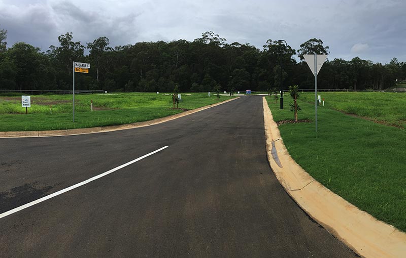
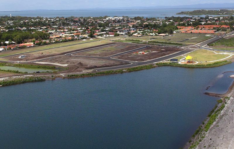
DSQ has extensive experience in land development in Sunshine Coast, Moreton Bay, Brisbane City, Western Downs and Toowoomba.
DSQ can assist with your land development project from inception, through to planning & approvals, onto construction and to completion with land titling and plan sealing.
DSQ has recent expertise in laser scanning, which is another service we offer in the emerging technology of point cloud data.
Laser scanning techniques provide an opportunity for the rapid survey of intricate and inaccessible surfaces, providing a high density 3D scan data and imaging. This method of survey eliminates the need to place surveying personnel in unsafe environments and significantly reduces time performing field survey.
DSQ has expertise in laser scanning for:
• Structures (buildings, bridges, pipework)
• Survey of inaccessible areas (eg. road surfaces, quarry faces, stockpiles)
• Earthworks volumes
DSQ utilises the Trimble SX10 scanning total station equipment to perform laser scanning surveys.
We use Trimble Business Centre software to integrate survey data, Trimble RealWorks for point cloud processing and AutoCad Civil 3D to reduce and present spatial data.
Preparation of survey plans of mining tenures in accordance with Queensland Mines and Energy survey requirements:
• Mining claims
• Mining leases
• Exploration permits
• Licences
• Petroleum leases
• Petroleum well location surveys
At DSQ, we have the experience and resources to provide surveying services to any size project.
Our team has a wide range of experience in particular on projects such as:
• Pipelines
• Roads
• Dams / Ponds
• Railways
• Powerlines
We can provide services including:
• Project survey control networks
• Expert advice on land titling and tenure issues
• Route selection and profiling
• Cultural heritage surveys
• Environmental mapping
• Detail and level surveys
• Easement and resumption surveys
• Control surveys
• Construction setout including machine guidance
• As-constructed surveys
• GIS submissions & As Builts
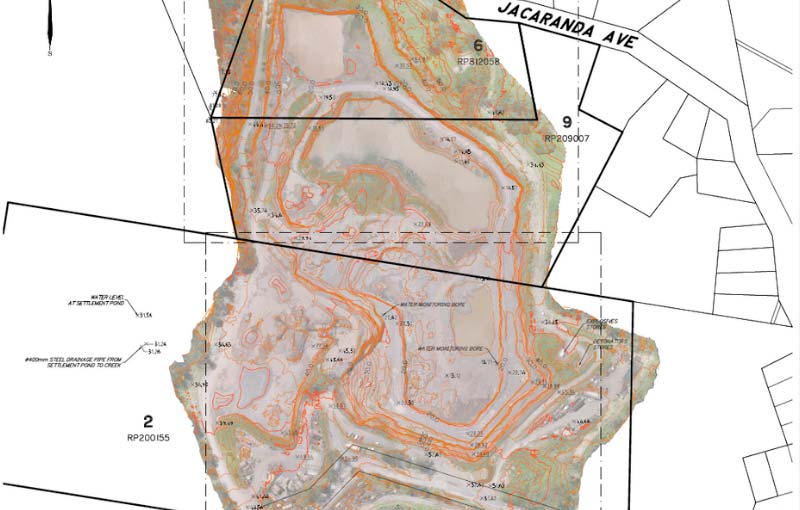
DSQ utilises drone technology to undertake remote controlled flights to record aerial and thermal imagery for a variety of uses.
DSQ has two CASA certified UAV pilots to undertake commercial flights with our Asctec Falcon 8 remote controlled drone helicopter.
The AscTec Falcon 8 Unmanned Aerial Vehicle (UAV) can add a more detailed, informative element to your project, with substantial cost savings:
• Diverse aerial imaging projects.
• Designed for aerial photogrammetry and videography.
• Ideal for detailed inspection work, 3D documentation of construction, mining and deformation monitoring.
• The AscTec Falcon 8 is a high-tech micro UAV with flexible camera and sensing options to suit your application.
• It is a proven and tested solution for high precision aerial mapping for applications including:
– Broad Mapping
– Surveying inaccessible areas (e.g. quarry)
– Site monitoring
– Thermography
– Post disaster work
– Industrial inspection
• The AscTec Navigator is a fully integrated software solution, tagging aerial images and flight data for geo-referenced applications and geocoding.


